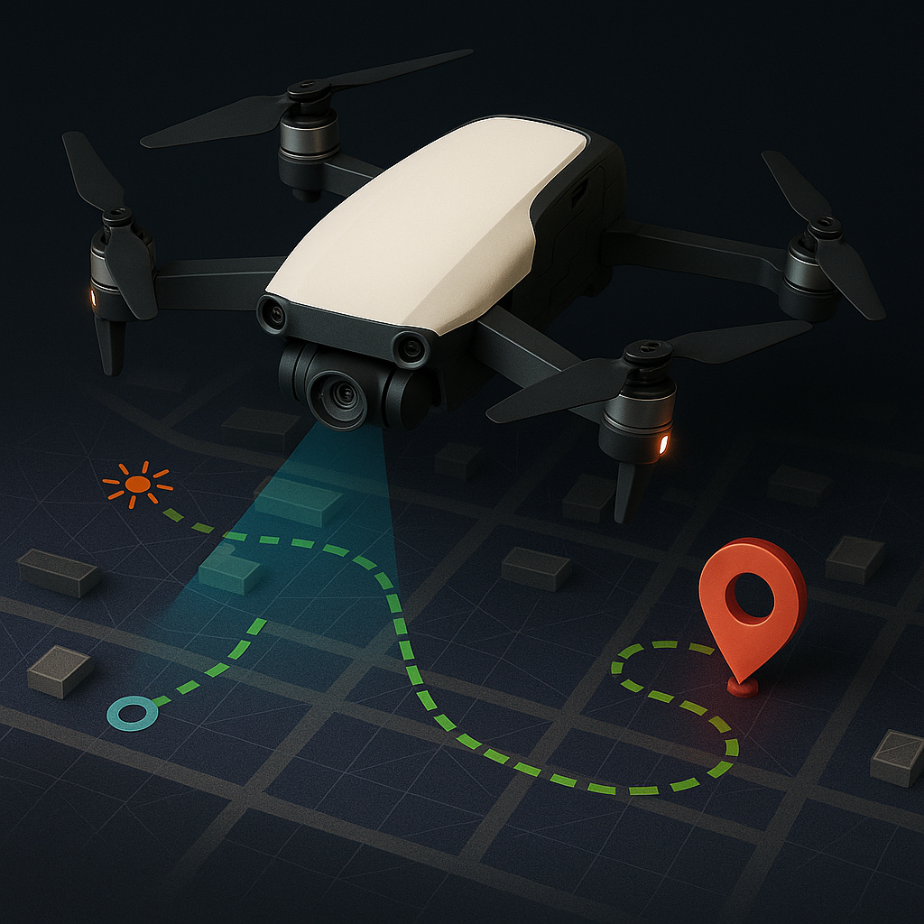
Real-time Pathfinding
ResQon's advanced pathfinding system creates optimal rescue routes in real-time, enabling rescue teams to navigate safely and efficiently through complex building layouts during emergency situations.
Using a combination of building floor plans, dynamic environment mapping, and AI-driven decision making, our system calculates the safest and most direct paths to reach survivors while avoiding hazards and impassable areas.
How It Works
Our pathfinding system combines pre-loaded building information with real-time sensor data to generate optimal rescue routes that adapt to changing conditions during emergency situations.

Building Map Integration
The system starts with digital floor plans of the building, including detailed information about room layouts, corridors, stairwells, and potential escape routes. This provides the baseline map for navigation.
Real-time Environmental Mapping
As the drone navigates through the building, it continuously scans and updates the environmental map, identifying new obstacles, blocked passages, and structural changes caused by the emergency.
Path Calculation
Using advanced algorithms, the system processes the updated map to generate optimal paths between the rescue team's position and identified survivors, considering factors like distance, safety, and accessibility.
Real-time Transmission
The calculated paths are immediately transmitted to rescue team devices, providing clear visual guidance through AR displays and simple directional indicators that work even in low-visibility conditions.
Key Technologies
Our pathfinding system integrates several advanced technologies to provide accurate and reliable navigation guidance in emergency scenarios.
SLAM Technology
Simultaneous Localization and Mapping (SLAM) algorithms allow the drone to create detailed 3D maps of the environment while simultaneously tracking its position within that environment, even without GPS signals.
A* Pathfinding
Our enhanced A* algorithm optimizes path selection by considering multiple factors including distance, heat levels, structural integrity, and known hazards to determine the safest and most efficient route for rescuers.
Dynamic Rerouting
The system continuously monitors the environment and can instantly recalculate paths if new obstacles are detected, paths become blocked, or safer routes emerge as conditions change during the rescue operation.
Building Information Modeling
Integration with Building Information Modeling (BIM) data provides detailed structural information, allowing the pathfinding system to consider wall materials, support structures, and other architectural elements in its calculations.
AR Visualization
Augmented Reality interfaces display navigation data directly in rescuers' field of view, with intuitive visual cues that can be followed even in low-visibility conditions, keeping hands free for rescue operations.
Mesh Network Communication
Our drones establish a self-forming mesh network that extends communication range even in signal-challenging environments, ensuring pathfinding data reaches rescue teams regardless of building materials or infrastructure damage.
Key Benefits
ResQon's pathfinding capabilities deliver significant advantages for emergency rescue operations.
Reduced Response Time
Optimized path calculation reduces the time needed to reach survivors by up to 43% compared to traditional search methods, significantly increasing survival rates in time-critical situations.
Enhanced Rescuer Safety
By identifying hazards and calculating safer routes, the system reduces rescuer exposure to dangerous conditions, minimizing the risk of injury during emergency operations.
GPS-Independent Navigation
The system functions independently of GPS signals, allowing for reliable indoor navigation through multiple floors, basement levels, and signal-blocking structures.
Adaptive Decision Making
Real-time response to changing conditions ensures that rescue teams always have current information, even when the emergency situation evolves rapidly during the operation.
Protocol Integration
ResQon's pathfinding system integrates seamlessly with existing emergency response protocols, enhancing operations without disrupting established procedures.
Command Structure
Pathfinding data flows through the established incident command system, providing enhanced information without changing operational hierarchies or decision-making chains.
Team Communication
Path information is distributed to team members according to existing communication protocols, with options for integration into radio systems and other standard communication channels.
Training Requirements
The intuitive interface minimizes additional training needs, with most fire departments requiring just 4-6 hours of familiarization to effectively utilize the system during operations.
Case Study: Multi-Floor Commercial Building
Chicago Fire Department Implementation
During a simulated high-rise emergency exercise, ResQon's pathfinding system was tested against traditional navigation methods in a 20-story commercial building with multiple fire outbreak points and simulated structural failures.
Technical Specifications
Pathfinding System
Navigation Interface
Navigate with Confidence
Discover how ResQon's real-time pathfinding technology can enhance your emergency response capabilities and improve rescue success rates.